MOUNT PELÉE
Description
Mount Pelée, an explosive volcano, whose eruption in 1902 is the first reported case of a Peléan eruption. This was the deadliest of the 20th century, its cloud of fire had covered and devastated the city of Saint-Pierre on May 8th, 1902.
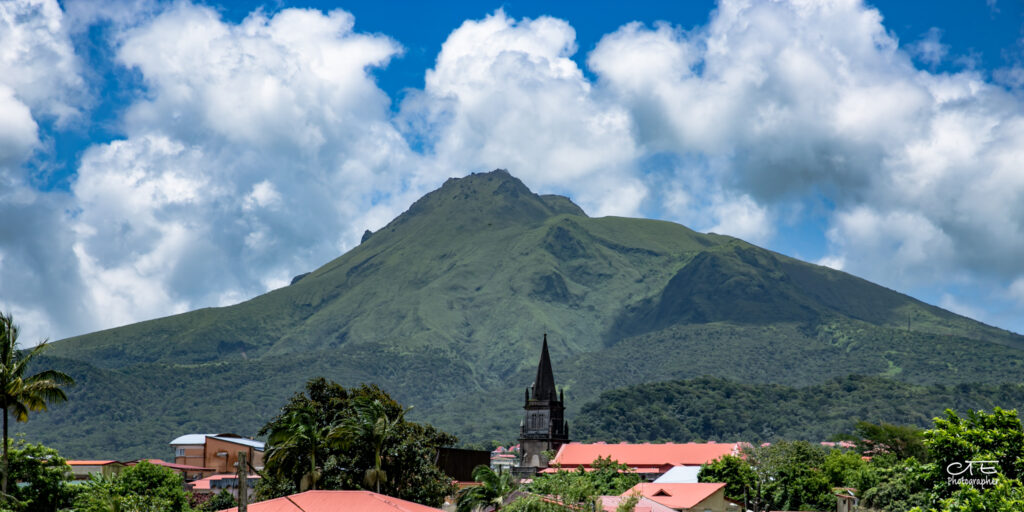
Its activity then declined, especially since the eruption from 1929 to 1932 that gave rise to its new dome. Rising 1,397 meters above sea level, it is the highest point in Martinique. Located in the north of the island, it dominates the landscape and offers an exceptional panorama when the weather is good.
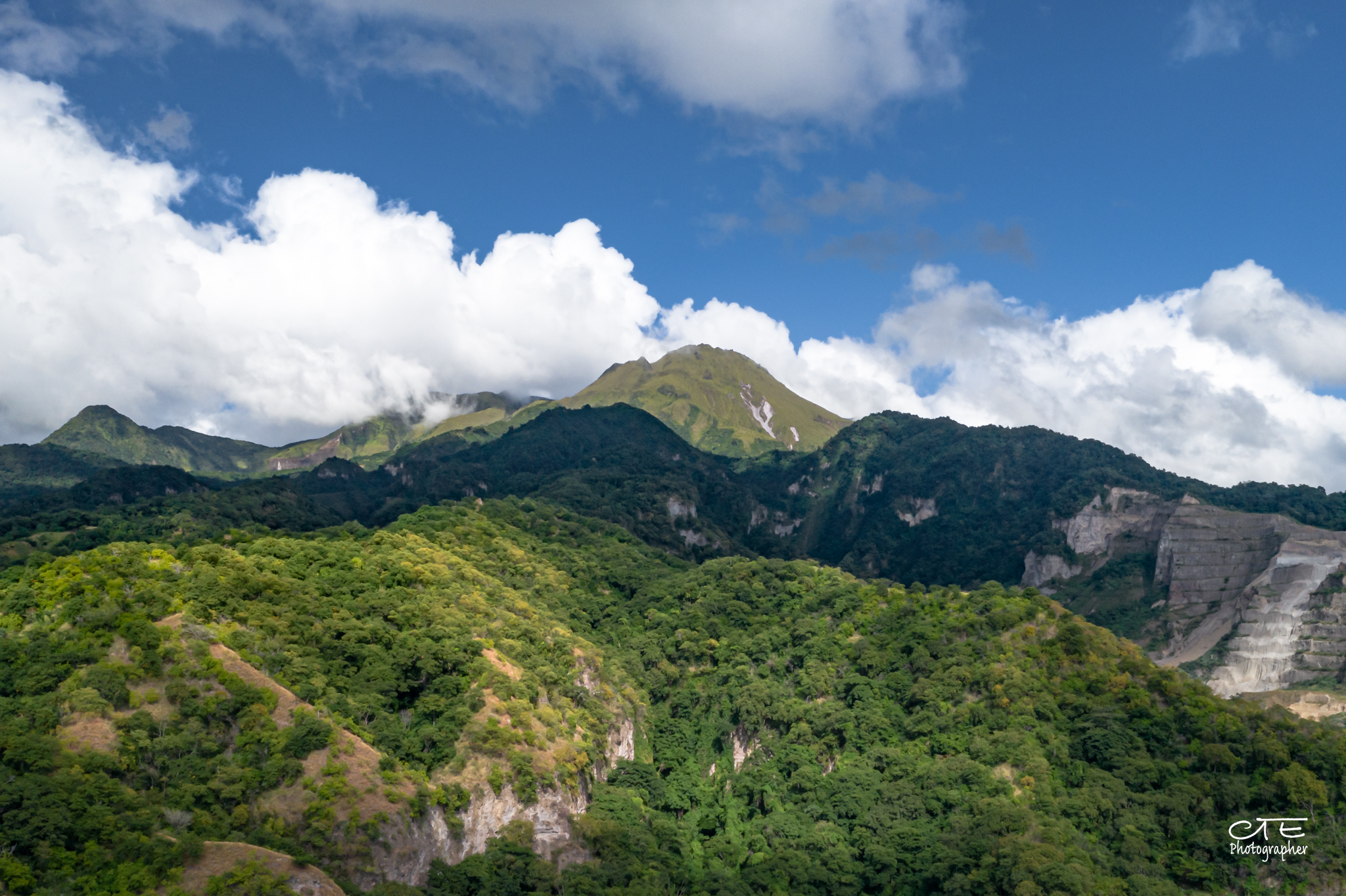
Mount Pelée is an active volcano, which is why it is constantly monitored by the Martinique Volcanological and Seismological Observatory. This observatory, located northwest of the Pitons du Carbet offers a stunning view of its mountains, the volcano and the northwest of the island.
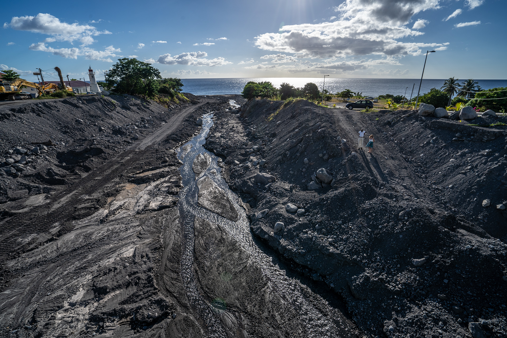
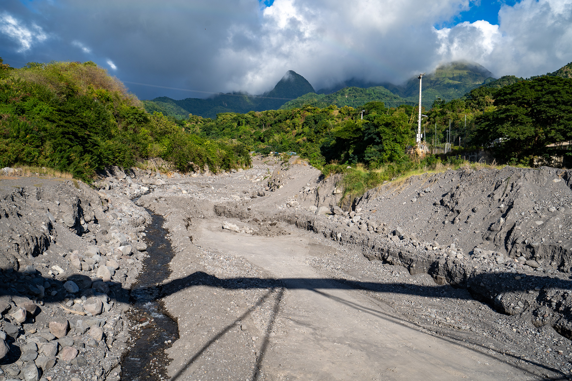
Martinique and, in particular, the city of Le Prêcheur are marked by the activity of the volcano and its lahars, a natural phenomenon last observed in 2018 on the island. The Samperre cliff had detached, creating a landslide and various volcanic materials agglomerated on the side of the mountain, rolled down the slope. It was then, at the level of the Abymes River, where these materials were spilled. Mixing with the water, they started to move and caused the landslide.
Biodiversity
The 2,285 ha of the Montagne Pelée massif were classified as an Integral Biological Reserve in 2007. The Montagne Pelée forest is very rich, its flora includes a large number of species of high heritage value with a very restricted geographical distribution. It houses at least one plant species strictly endemic to the area: Clidemia latifolia. Other species, considered endangered, appear in the difficult-to-access areas of the flanks of the volcano and seem out of danger in these places: the fat pork (Chione venosa) or the Ternstroemia elliptica.
There are different types of emblematic forests of the Lesser Antilles since it presents a highly diversified stratification of vegetation over very short distances, in particular:
- Seasonal evergreen tropical forest (130 to 450 m),
- The submontane tropical rainforest (450 to 650 m),
- The insular low mountain forest (700 to 900 m),
- Semi-arboreal formations of the upper volcanic ridges (900 to 1100 m),
- Low altitude formations (above 1000 – 1100 m).
In terms of fauna, the forest of Mount Pelée is a very important habitat that has already lost numerous emblematic species like the parrots (Ara guadeloupensis or Amazona martinica). Other species of reptiles and the largest known colony of Schwartz’s myotis (Myotis martiniquensis), rare bats endemic to Martinique, take refuge in this forest. Lastly, it is also one of the main reservoirs of the island’s avian fauna.
Ecotourism potential
Mount Pelée offers three hikes with various levels of difficulty, allowing everyone to explore it at their own pace:
- Trail no. 23, starting from the Aileron car park (Ajoupa Bouillon, Morne Rouge). With 4.7 km, 600 m incline, 4 hours of walking (round trip).
This is the easiest access to Mount Pelée to reach by car and the most popular.
After reaching the Ailerón dome, the path continues to the Caldera, which it borders before reaching the “Chinois” (summit of the 1929 cone). On a clear day, you can admire the view of the Pitons du Carbet, the bay of Fort de France and the Caravelle peninsula.
- Trail no. 19 from Grande Savane (Prêcheur). With 1.5 km, 470 m incline, 2 hours of walking (round trip).
The trail at the top links that of Morne Plumé to the Caldera, where you can enjoy a magnificent view of Saint-Pierre. You can also reach the 3rd refuge and the “Chinois”.
- Trails n° 21 from Beauséjour (Grand-Rivière) or n° 22 from Desiles (Macouba). From Beauséjour it is 7.6 km, 1170 m incline and 4.5 hours of walking (round trip). While, from Désiles: 8 km, 1,220 m incline and 4.5 hours of walking (round trip).
Cross the agricultural roads (banana plantations, sugar cane) to the Maison du Moine, then go up to Morne Macouba (1300 m, one of the remains of the primitive volcano of Pelée), to reach the second refuge (then the possibility opens up to go to the “Chinois”).
On the other hand, it is possible to visit the Franck Perret museum in Saint-Pierre, the regional house of the Volcano in Morne-Rouge or the Earth Sciences Discovery Center, places where the particularities of the “Peléan” eruptions are explained very well.
Informations
-
-
Location
Martinique (Précheur)