MA KÔTÉ MANGROVE – SAINTE-LUCIE
Description
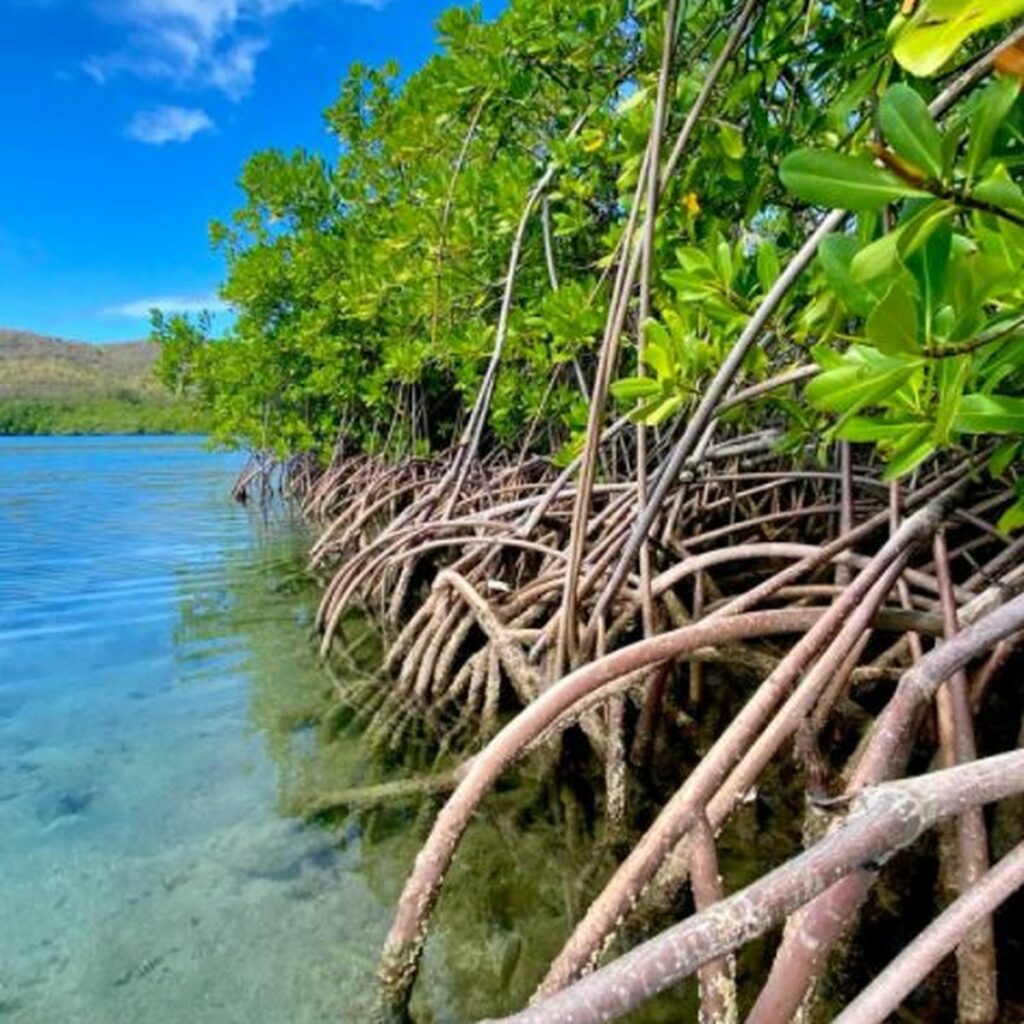
The Ma Kôté mangrove, also known as Mankote, is the largest in Saint Lucia (20% of the island’s total mangrove area), covering an area of 40 hectares, and is located on the southeast coast of Vieux Fort. It was designated a marine reserve under the Fisheries Act in 1986 and declared a wetland of international importance under the RAMSAR Convention in 2002.
This natural site plays several important roles: it serves as the main source of food for fish nurseries and allows the local community to engage in subsistence activities such as fishing and charcoal production.
Due to soil erosion, wildlife is limited in this area. In fact, in 2015, a severe case of mangrove dieback was confirmed following a field inspection by the Saint Lucia National Trust, conducted after images were first revealed by Google Earth. However, satellite images showed that this dieback was already present five years earlier.
In response, various stakeholders are working together to protect the mangrove by developing a strategic rehabilitation plan. This plan includes reforestation efforts and community awareness-raising, particularly among young people, through educational field trips.
Several factors have led to this situation, such as overexploitation of resources and malfunctions in the hydrological system, resulting in insufficient freshwater supplies and high salinity levels.
Biodiversity
The mangrove vegetation is characterized by typical species such as white mangrove (Laguncularia racemosa), gray mangrove (Conocarpus erectus), red mangrove (Rhizophora mangle), and black mangroves (Avicennia germinans and Avicennia schaueriana).
This site is also home to a rich and varied fauna. As the largest mangrove on the island, it is an essential nursery for fish and crustaceans, including the sea pike (Centropomus undecimalis), blue crab (Callinectes danae), white mullet (Mugil curema), mangrove oyster (Crassostrea rhizophorae), Nile tilapia (Oreochromis niloticus), and common land crab (Cardisoma guanhumi), among others.
There are also many birds, such as the osprey (Pandion haliaetus), the western wood-warbler (Protonotaria citrea), the lesser manakin (Coccyzus minor), the red-necked phalarope (Nomonyx dominicus), the tricolor egret (Egretta tricolor), the black-bellied sandpiper (Tringa melanoleuca), the semipalmated sandpiper (Calidris pusilla), the yellow-bellied sugarbird (Coereba flaveola), the peregrine falcon (Falco peregrinus), the green-throated hummingbird (Eulampis holosericeus), and many others.
Ecotourism potential
The site is jointly managed by the Departments of Fisheries and Forestry, the Caribbean Natural Resources Institute (CANARI), and the Aupicon Agricultural and Charcoal Producers Group. The mangrove is also part of the Pointe Sables Environmental Protection Area (PSEPA).
Guided tours are organized by the St. Lucia National Trust and the Caribbean Natural Resources Institute. They aim to raise visitors’ awareness of the rich biodiversity of this environment, with a particular focus on its wildlife, including opportunities for bird watching.
Sources
Mankote Mangroves | Open Green Map
Ma Kôté Mangrove Forest Assessment – Saint Lucia National Trust
Die-Back in Ma Kôté Mangrove Forest – THE STAR – St Lucia (stluciastar.com)
Restoration of Saint Lucia’s Ma Kote Mangrove (youtube.com)
Mangrove ecosystems of Saint Lucia – UNESCO Bibliothèque Numérique
Informations
-
-
Location
Saint Lucia (Ma kôté)