Soufrière’s Volcano
Description
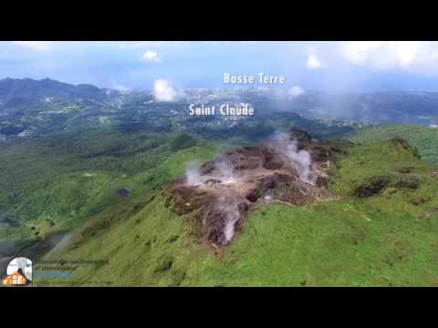
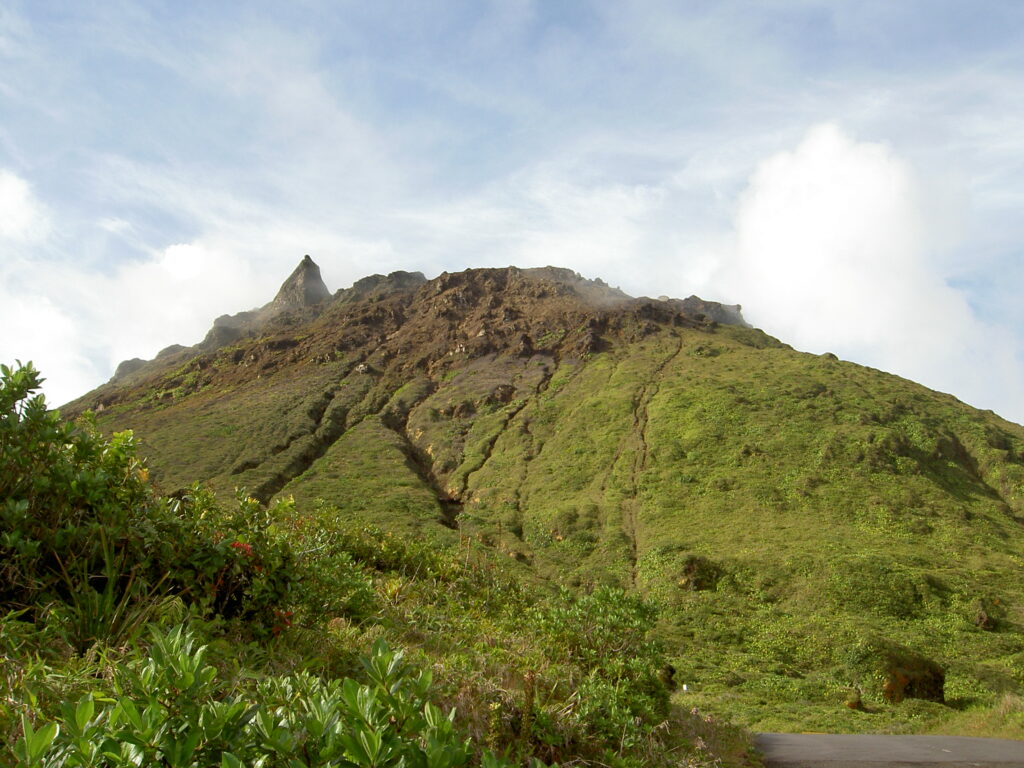
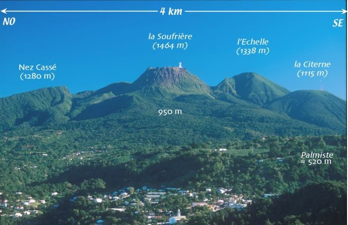
La Soufrière, Guadeloupe’s only active volcano*, is the highest point in the Lesser Antilles at an altitude of 1,467 meters. Also know as “The Old Lady” by the locals due to the pleated skirt shape of its crater, it belongs to a volcanic group along with five other extinct volcanoes (La Citerne, la Madeleine, l’Échelle, Carmichaël and la Grande Découverte). In fact, it is a Pelean-type* stratovolcano* that emits fumaroles*, sulfurous and acid vapors and hot springs (Yellow Baths, Dolé…), its last eruption dates back to 1976, when 70,000 people were evacuated from southern Basse-Terre.
Pour plus d'informations sur l'historique de la Soufrière et le plan d'évacuation en cas d'éruption : https://www.gip-raspeg.fr/minisite_11/media-files/501/5-specificites-du-plan-orsec-volcan-971.pdf

la Soufrière en temps quasi-réel : http://www.ipgp.fr/fr/ovsg/observatoire-volcanologique-sismologique-de-guadeloupe
Known and recognized, it is the flagship place to visit the National Park of Guadeloupe* and Saint-Claude, the city where it is located. It receives around 100,000 hikers a year at its summit from where it offers a panoramic view. These views, when the weather is good, are by far the best to be had in all of Guadalupe, its dependencies and Montserrat.
La Soufrière is part of more than 16,000 hectares of hygrophilous forest* (rainforest) in the National Park and is, up to 1,000 meters above sea level, the most representative area of this forest formation. The climate is cool (between 15 and 22 degrees), its flora is remarkable and it is home to surprising endemic animal species due to its location.
Above 1000 meters, it is the highland forest that dominates, the vegetation is less lush because it suffers from violent winds and excessive humidity (7 to 12 m of rain per year).
Biodiversity
The diversity and originality of the species that inhabit this forest are possible thanks to a particular climate: high rainfall and equally present sun.
Vegetation is defined by volcanic events and altitude differences. The highest peaks are simply covered with mosses, lichens and lycopods (also known as lycophytes). In the high savannahs (over 1000 meters high) we find a shrub known as “Mangle montagne“; while in the areas affected by acid vapors between 1998 and 2001, we can find bleached dead sphagnum moss and burnt shrubs. In the lower areas there are grasses, red and yellow-mountain pineapples, and shrubs. Still further down, there are fairly light yellow-orange sphagnum formations also known as peat moss.
Despite the complexity of life in the mountains, under the big stones it is possible to find Soufrière’s mygales (Holothele sulfurensis), an endemic arachnid species of this beautiful biotope*.
ECOTOURISM POTENTIAL
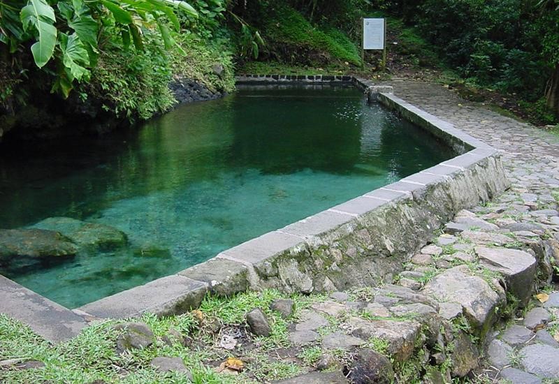
La Soufrière is a green tourism area which, due to the diversity of its natural heritage, attracts everyone. It is possible to climb as a family as long as you check the weather conditions and you are well equipped. Majestic and full of secrets, it offers the chance to identify at least eight colors of clay*, as well as various plant species, rocks, and landscapes of all kinds, on a guided or independent tour. The view, the “carbets” (wooden shelter without a wall typical of Amerindian cultures), and the yellow baths at its feet, are great rewards that you can enjoy when going down or simply taking a walk through the area.
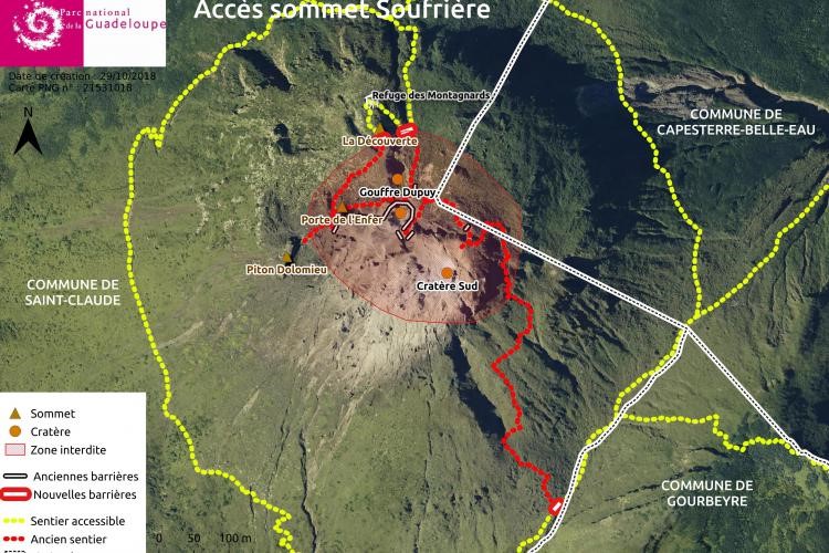
The discovery of this giant of the mountains is possible by the “Pas du Roy” track (about 30 minutes) and then by the hiking circuit: the “path of the ladies” (about 2h30 round trip) and the pass of the scale (around 3h15). For the more athletic it is possible, from the Maison forestière de Matouba or the House of the Forest of Matouba (about 6 hours round trip), to walk through Carmichael to reach the top. It is important to mention that the great walk of Guadeloupe or grande randonnée de Guadeloupe, crosses the Soufrière massif to reach the northern and southern ends of the island of Basse-Terre or Guadeloupe strictly speaking.
Link: virtual visit to the Soufrière’s Summit

Faites une visite virtuelle de la Soufrière !
https://visites-virtuelles.guadeloupe-parcnational.fr/soufriere/
Sources
https://www.gip-raspeg.fr/minisite_11/media-files/501/5-specificites-du-plan-orsec-volcan-971.pdf
https://www.ipgp.fr/~beaudu/soufriere.html