Dominica
751 km²
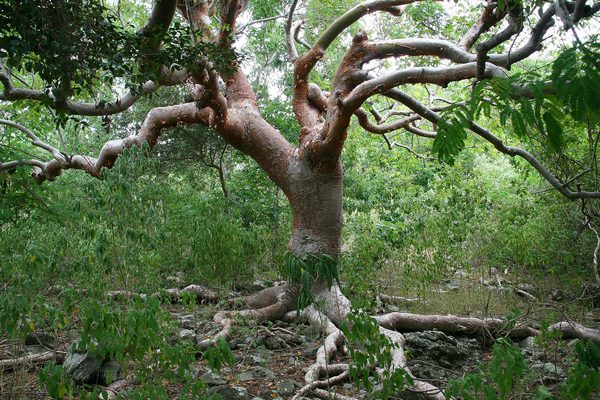
The dry forest in northeastern Saint Lucia is a unique ecosystem characterized by its arid conditions and vegetation adapted to drought. Stretching along the northeast coast of the island, this forest is home to rich biodiversity and archaeological sites that bear witness to the presence of the first Amerindian inhabitants.
Discover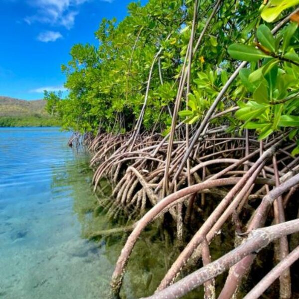
The Ma Kôté mangrove, also known as Mankote, is the largest in Saint Lucia (20% of the island’s total mangrove area), covering an area of 40 hectares, and is located on the southeast coast of Vieux Fort. It was designated a marine reserve under the Fisheries Act in 1986 and declared a wetland of international importance under the RAMSAR Convention in 2002.
Discover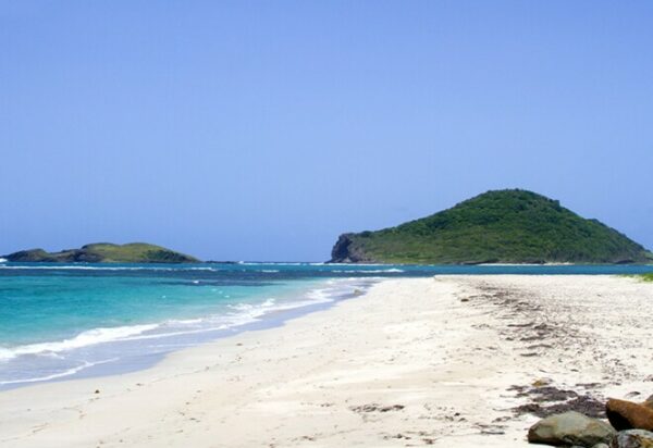
The Maria Islands Nature Reserve, declared a nature reserve in 1982, consists of two small uninhabited islets located a short distance off the southeast coast of Saint Lucia. The larger of the two islands, called Maria Major, covers approximately ten hectares.
Discover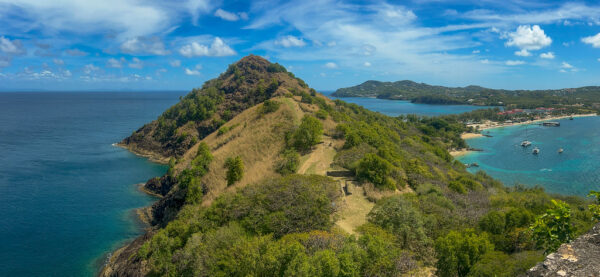
Pigeon Island National Park, originally designated a national park in 1979 and then a national monument in 1992, is a picturesque 18-hectare reserve located in Gros Islet, in the north of the island of Saint Lucia.
Discover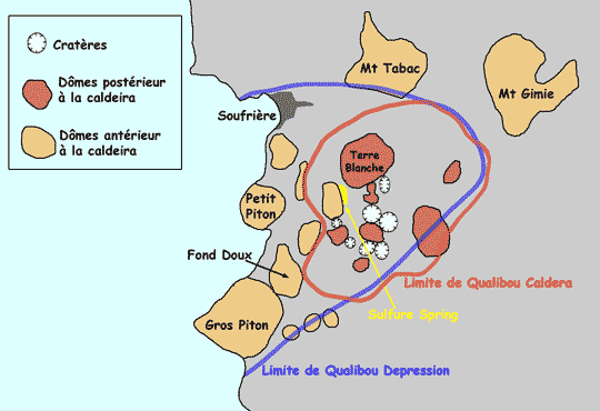
Qualibou, also known as the Soufrière volcanic center, is a volcano consisting of a caldera located in the southwest of the island. Partially submerged by the Caribbean Sea, it extends 5 kilometers in length and 3.5 kilometers in width.
Discover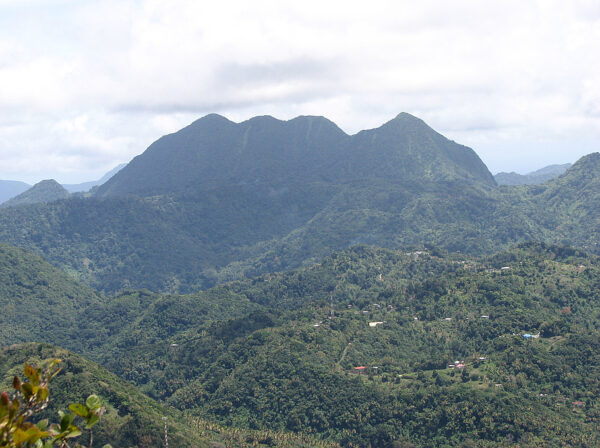
Mount Gimie, rising to an altitude of 950 meters, is the highest mountain in Saint Lucia. Its altitude allows visitors to enjoy many exceptional views of the island. Located in the southwestern part of the island, it is part of the central rainforest mountain range within the Pitons National Park.
Discover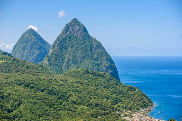
Located on the southwestern coast of the island of Saint Lucia, the Pitons, connected by the Piton Mitan ridge, are the two highest peaks of the Qualibou volcanic chain, also known as La Soufrière.
Discover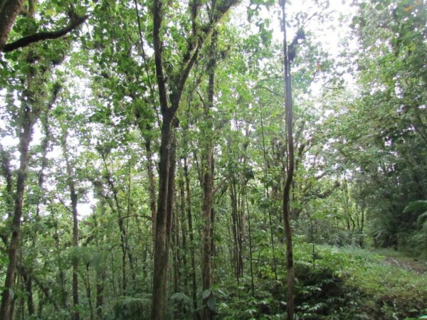
Edmund Forest Reserve is a forest reserve located in a mountainous region west of Saint Lucia. Its protection and maintenance are ensured by the Saint Lucia Forestry Department.
Discover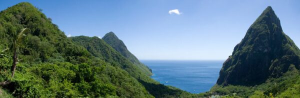
The Barre d’Isle ridge is an important topographical feature of Saint Lucia. It crosses the central part of the island and extends from northeast to southwest, acting as a natural dividing line between the eastern and western regions of the island. The ridge is notable for its altitude of 285 meters and its hilly terrain, alternating between thick canopy and open areas.
Discover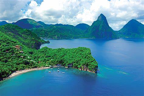
Anse Chastanet is a reef located in a marine protected area on the southwest coast of Saint Lucia. Considered one of the most beautiful reefs on the island, Anse Chastanet has also become one of the most popular scuba diving sites, thanks in part to the nearby hotels. The access areas to the reef are marked by a floating rope in four sections, accessible from the beaches of Anse Chastanet and Anse Mamin.
Discover