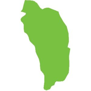
Dominica
751 km²
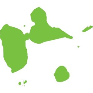
La Guadeloupe est un archipel aux formations géologiques et paysagère très diversifiés. Territoire volcanique et calcaire, les îles de Guadeloupe sont un spectacle pour les amateurs et initiés à la découverte du patrimoine naturel caribéen.
The Grand cul-de-sac marin is a coastal wetland* conducive to the reproduction of terrestrial and maritime flora* and fauna. The “Rivière Salée” is a natural strait that connects the Grand and the Petit Cul-de-sac Marin and unites the Atlantic Ocean and the Caribbean Sea.
Discover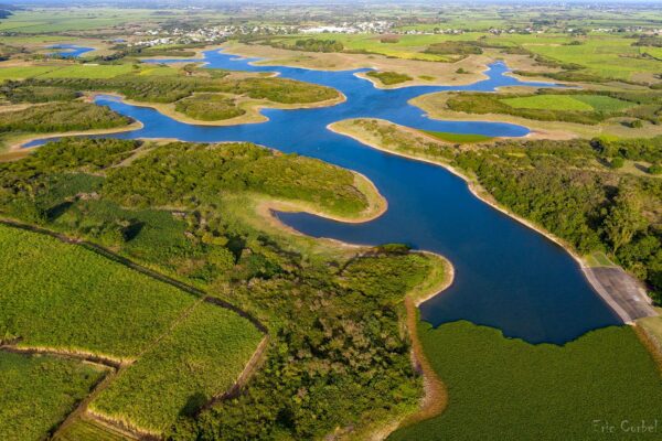
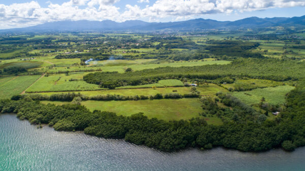
It is in the heart of Grande-Terre, between Port-Louis and Petit-Canal, that the largest body of freshwater in Guadeloupe is located. Built in the late 1980s to irrigate dryland agricultural land in the north of the island, this artificial dam is a biodiversity reserve.
Discover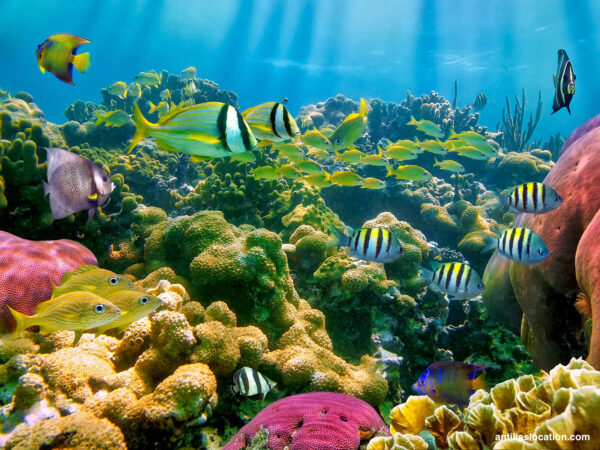
1100 meters away from the coast of the municipality of Bouillante, are the Pigeon islets or Goyave islets. With a total area of 8 ha (7 ha for the large islet and 1 ha for the small one), both islets are formed by volcanic substrate. Separated by a 30 meter channel, they harbor a very important marine biodiversity in their waters.
Discover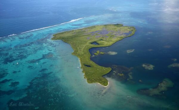
The islet of Fajou is the largest of Grand Cul-de-Sac Marin, located to the east, it covers an area of 119.5 hectares. About 6 km north of the mouth of the Rivière Salée and about 6 km west of the Vieux-Bourg cove, it emerges from a shallow area limited to the north by the coral
reef.
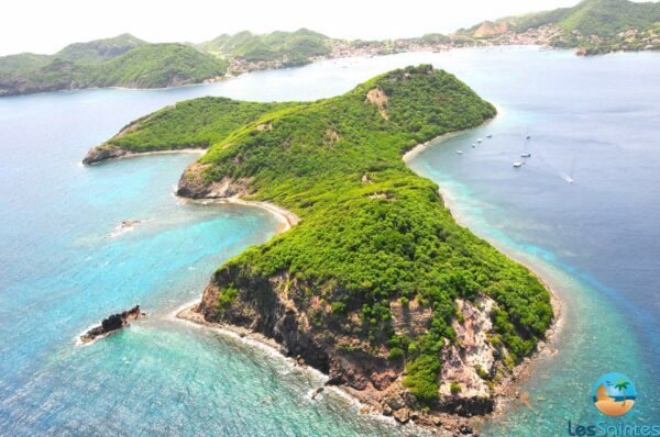
Cabrit’s island, an uninhabited island of almost 38 ha, has retained its wild character with 3.8 km of coastline. Located in the bay of Terre-de-Haut, just 1.2 km away, it played an important role in the constitution of the defensive system, as a fortified lock at the entrance to Les Saintes
between the 16th and 18th centuries.
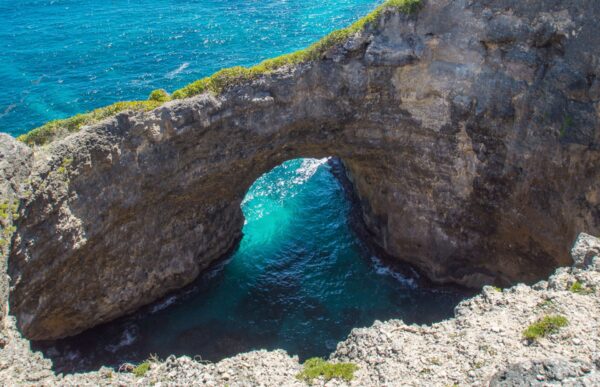
From the viewpoint, it is possible to observe this 30-meter arch formed under the effect of the waves, where the waves break and the foam hits.
Discover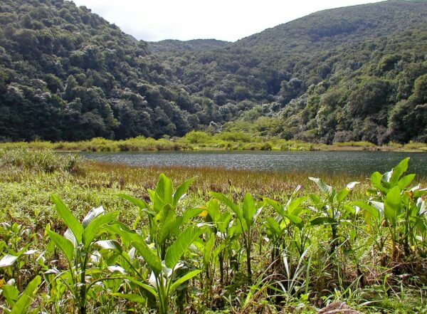
The Grand-Étang, a natural depression* located 400 meters above sea level, covers an area of 5 hectares and has a depth of up to 10 meters in some places. This makes it the largest lake in the Basse-Terre’s mountain range.
Discover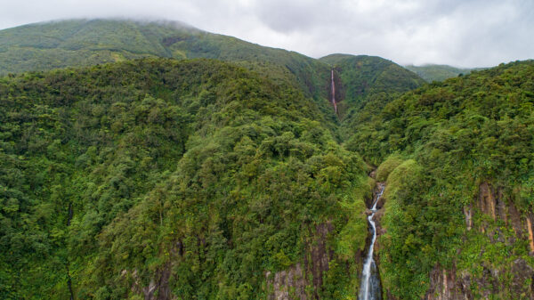
Located on the eastern flank of La Soufrière, the Grand Carbet river is famous for its three waterfalls. The first is the highest with a jump of 115 meters between two levels.
Discover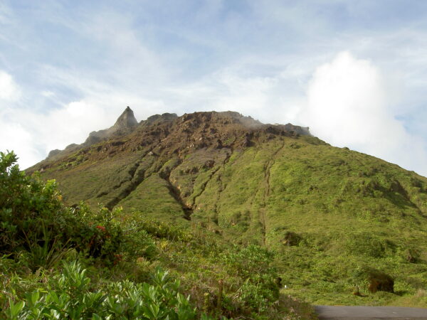
La Soufrière, Guadeloupe’s only active volcano*, is the highest point in the Lesser Antilles at an altitude of 1,467 meters. Also know as “The Old Lady” by the locals due to the pleated skirt shape of its crater, it belongs to a volcanic group along with five other extinct volcanoes (La Citerne, la Madeleine, l’Échelle, Carmichaël and la Grande Découverte).
Discover
Located in the commune of Morne-à-l’eau, the “Canal des Rotours” was dug over nearly 6 kilometers by more than 300 free or enslaved men between 1826 and 1829. It begins in the Grippon’s plain, crosses the town, and flows into the Grand-Cul-de-Sac Marin at Pointe à Feuille, not far from Vieux-bourg.
Discover