ISLE RIDGE BAR
Description
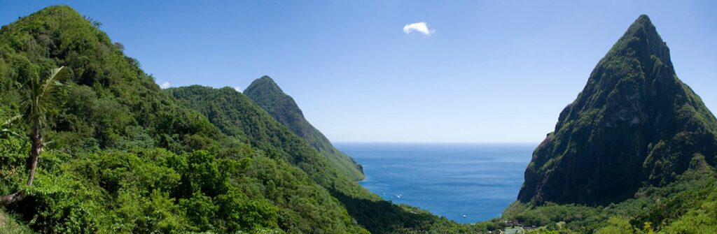
The Barre d’Isle ridge is an important topographical feature of Saint Lucia. It crosses the central part of the island and extends from northeast to southwest, acting as a natural dividing line between the eastern and western regions of the island. The ridge is notable for its altitude of 285 meters and its hilly terrain, alternating between thick canopy and open areas.
The Saint Lucia Forestry Department is responsible for its maintenance and protection. In collaboration with Fauna & Flora, an international charity dedicated to nature conservation, they are working to preserve the incense trees (Protium attenuatum), a tree endemic to the Lesser Antilles and threatened with extinction, which are found on the site.
Biodiversity
The vegetation is characterized by a dense canopy, tree ferns, bamboos, and palms, as well as species such as the strangler fig (Ficus aurea), red ginger (Alpinia purpurata), wild orchid (Spathoglottis plicata), foufou wood (Palicourea crocea), Caribbean heliconia (Heliconia caribaea), and incense wood (Protium attenuatum).
The fauna is just as diverse. You can see the Madeira hummingbird (Eulampis jugularis), the Dryas iulia butterfly, the St. Lucia parrot (Amazona versicolor), a bird endemic to the island, and land crabs.
Ecotourism potential
Halfway between Castries (the capital) and the village of Dennery on the east coast, visitors can access a 2.9-kilometer hiking trail, which takes about two hours to complete. It takes about 25 minutes by bus or car to reach the trailhead. A hiking fee of EC$25 (€8.50) per person must be paid to a park ranger before starting the trail. This fee contributes to its maintenance and protection by the forestry department. Access to the trail is prohibited without authorization.
Equipped with a map provided by the ranger, you will discover numerous signs along the trail, with 28 stops labeled to identify the surrounding flora. The trail offers panoramic views of parts of the island from four vantage points, including Mount Gimie, the vast rainforest, Cul-de-Sac Valley, the Caribbean Sea, the vast Mabouya Valley, and Fond d’Or Beach on the Atlantic coast. It ends with a steep climb up Mount La Combe, which rises to 438 m, from where you can see the Roseau and Mabouya valleys. It will take about an extra hour to climb this mountain.
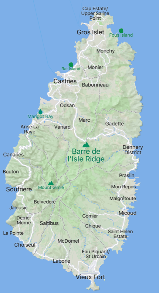
Map location
Sources
Barre de L�isle / Morne La Combe – Central Forest Reserve, St Lucia (naturalbornhikers.com)
Barre de L’Isle | Kaï Papaï, St Lucia: more than tourism! (kaipapai.com)
Barre de l’Isle Ridge Map – Saint Lucia (mapcarta.com)
Barre de l’Isle Rainforest Trail, Dennery Quarter, Saint Lucia – 3 Reviews, Map | AllTrails
Informations
-
Types de milieux
Crêtes -
Location
Saint Lucia (L'Isle Ridge)