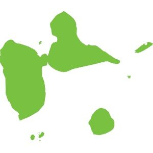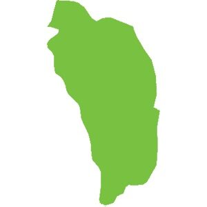
Dominica
751 km²
Caribbean natural sites make up the biodiversity hotspot we know. For example:
The wealth of these islands stems from their volcanic geological history (histoire géologique liée aux volcans). There are currently 21 active volcanoes in the Caribbean. Although some have been dormant for several years, there is at least one on each island, from Saba to Grenada, except in Dominica where there are 9.
Mount Duarte, the highest peak in the Caribbean, is located in the north of the Dominican Republic and reaches an altitude of 3,098 m. Its mountain range extends to the northern massif of Haiti. The highest peak in the Lesser Antilles is the active volcano of La Soufrière (La Soufrière) in Guadeloupe, reaching an altitude of 1,467 m.
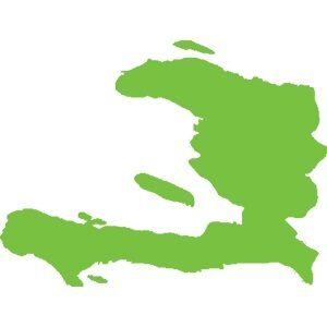
Haiti, adorned with geological assets and in particular numerous caves including:,( Marie-Louise Boumba), Jean Zinga but also and above all the Marie-Jeanne cave,(grotte Marie-Jeanne), the longest in the Caribbean with its 5.3 km of gallery. Located at an altitude of 120 meters in the commune of Port-à-Piment in the department of South Haiti, it is classified, to this day, as the largest underground heritage of Haiti.
Guadeloupe and its archipelago hide many secrets with its dual formation (volcanic and limestone). Marie-Galante, formerly attached to Grande-Terre, is a small, flat but surprising island. Discover the Gueule Grand Gouffre or Désirade, the oldest island in the Lesser Antilles, facing the Pointe des Châteaux (the most visited site in Guadeloupe) and the management of Petite-Terre, the only island home only to West Indian iguanas iguanes antillais.
In terms of forest diversity, our territories are home to forests of all types: xerophilous forest, mesophilous forest, hygrophilous forest, high-altitude forest, mangrove… In Haiti, the Pine Forest, located at an altitude of over 2,000 meters, forms a vast, important and emblematic expanse of tropical and subtropical coniferous forests.
Underwater, life abounds. In Guadeloupe, we find the Grand cul-de-sac marin where corals, fish and turtles coexist, sheltered by the largest coral reef in the Lesser Antilles.
In fresh water, many waterfalls are known, notably the Carbet Falls Chutes du Carbet with their history linked to the Amerindians living at their mouths in huts. But also the Saut-d'Eau Waterfall, Cascade Saut-d'Eau , emblematic in Haiti for pilgrimages.
Our biodiversity is rich and interconnected; for it to survive and stay healthy, we must protect every link in the chain. Forests, mangroves, seabeds, seas, rivers, lakes, ponds… all the ecosystems they shelter are a guarantee of the balance of our environment.
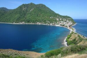
Located in the southwest of Dominica, the Soufrière-Scotts Head Marine Reserve is a bay originating from a vast extinct and submerged volcanic crater. The reserve covers about 6 to 7 square kilometers, bordering a coastline of mountains and hills. With a volcanic landscape, it is not surprising that the seascape is equally spectacular.
Discover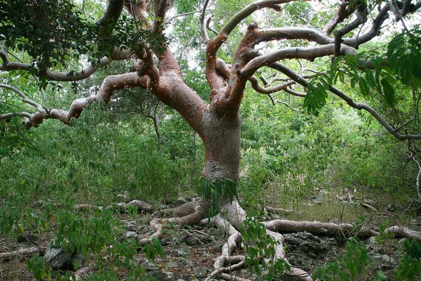
The dry forest in northeastern Saint Lucia is a unique ecosystem characterized by its arid conditions and vegetation adapted to drought. Stretching along the northeast coast of the island, this forest is home to rich biodiversity and archaeological sites that bear witness to the presence of the first Amerindian inhabitants.
Discover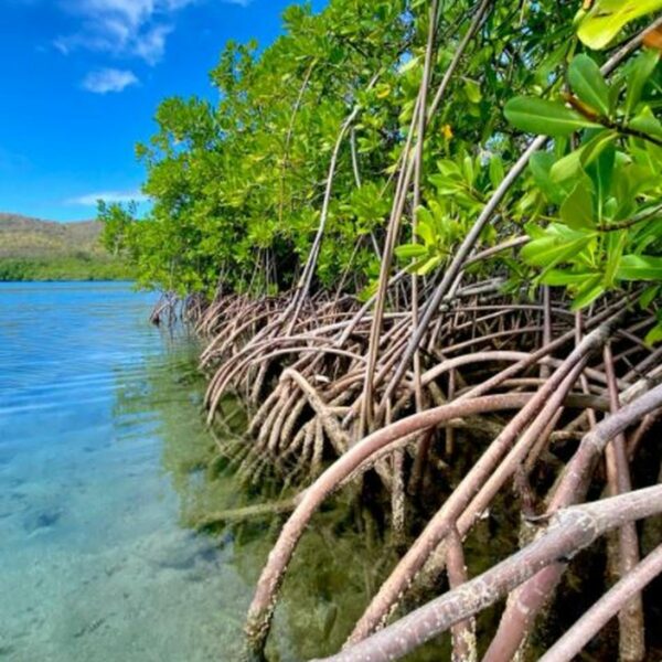
The Ma Kôté mangrove, also known as Mankote, is the largest in Saint Lucia (20% of the island’s total mangrove area), covering an area of 40 hectares, and is located on the southeast coast of Vieux Fort. It was designated a marine reserve under the Fisheries Act in 1986 and declared a wetland of international importance under the RAMSAR Convention in 2002.
Discover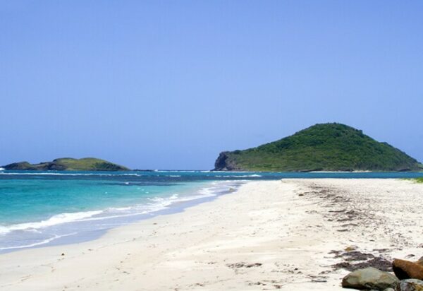
The Maria Islands Nature Reserve, declared a nature reserve in 1982, consists of two small uninhabited islets located a short distance off the southeast coast of Saint Lucia. The larger of the two islands, called Maria Major, covers approximately ten hectares.
Discover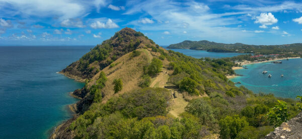
Pigeon Island National Park, originally designated a national park in 1979 and then a national monument in 1992, is a picturesque 18-hectare reserve located in Gros Islet, in the north of the island of Saint Lucia.
Discover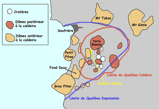
Qualibou, also known as the Soufrière volcanic center, is a volcano consisting of a caldera located in the southwest of the island. Partially submerged by the Caribbean Sea, it extends 5 kilometers in length and 3.5 kilometers in width.
Discover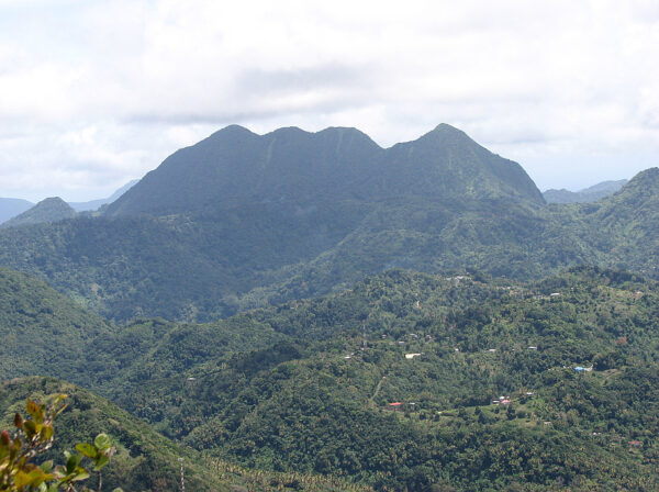
Mount Gimie, rising to an altitude of 950 meters, is the highest mountain in Saint Lucia. Its altitude allows visitors to enjoy many exceptional views of the island. Located in the southwestern part of the island, it is part of the central rainforest mountain range within the Pitons National Park.
Discover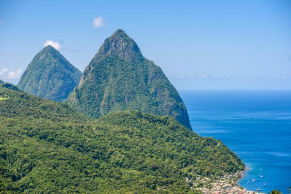
Located on the southwestern coast of the island of Saint Lucia, the Pitons, connected by the Piton Mitan ridge, are the two highest peaks of the Qualibou volcanic chain, also known as La Soufrière.
Discover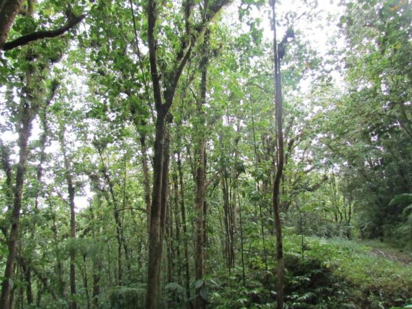
Edmund Forest Reserve is a forest reserve located in a mountainous region west of Saint Lucia. Its protection and maintenance are ensured by the Saint Lucia Forestry Department.
Discover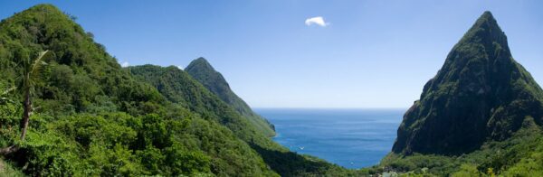
The Barre d’Isle ridge is an important topographical feature of Saint Lucia. It crosses the central part of the island and extends from northeast to southwest, acting as a natural dividing line between the eastern and western regions of the island. The ridge is notable for its altitude of 285 meters and its hilly terrain, alternating between thick canopy and open areas.
Discover