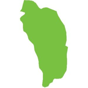
Dominica
751 km²
Caribbean natural sites make up the biodiversity hotspot we know. For example:
The wealth of these islands stems from their volcanic geological history (histoire géologique liée aux volcans). There are currently 21 active volcanoes in the Caribbean. Although some have been dormant for several years, there is at least one on each island, from Saba to Grenada, except in Dominica where there are 9.
Mount Duarte, the highest peak in the Caribbean, is located in the north of the Dominican Republic and reaches an altitude of 3,098 m. Its mountain range extends to the northern massif of Haiti. The highest peak in the Lesser Antilles is the active volcano of La Soufrière (La Soufrière) in Guadeloupe, reaching an altitude of 1,467 m.
Haiti, adorned with geological assets and in particular numerous caves including:,( Marie-Louise Boumba), Jean Zinga but also and above all the Marie-Jeanne cave,(grotte Marie-Jeanne), the longest in the Caribbean with its 5.3 km of gallery. Located at an altitude of 120 meters in the commune of Port-à-Piment in the department of South Haiti, it is classified, to this day, as the largest underground heritage of Haiti.
Guadeloupe and its archipelago hide many secrets with its dual formation (volcanic and limestone). Marie-Galante, formerly attached to Grande-Terre, is a small, flat but surprising island. Discover the Gueule Grand Gouffre or Désirade, the oldest island in the Lesser Antilles, facing the Pointe des Châteaux (the most visited site in Guadeloupe) and the management of Petite-Terre, the only island home only to West Indian iguanas iguanes antillais.
In terms of forest diversity, our territories are home to forests of all types: xerophilous forest, mesophilous forest, hygrophilous forest, high-altitude forest, mangrove… In Haiti, the Pine Forest, located at an altitude of over 2,000 meters, forms a vast, important and emblematic expanse of tropical and subtropical coniferous forests.
Underwater, life abounds. In Guadeloupe, we find the Grand cul-de-sac marin where corals, fish and turtles coexist, sheltered by the largest coral reef in the Lesser Antilles.
In fresh water, many waterfalls are known, notably the Carbet Falls Chutes du Carbet with their history linked to the Amerindians living at their mouths in huts. But also the Saut-d'Eau Waterfall, Cascade Saut-d'Eau , emblematic in Haiti for pilgrimages.
Our biodiversity is rich and interconnected; for it to survive and stay healthy, we must protect every link in the chain. Forests, mangroves, seabeds, seas, rivers, lakes, ponds… all the ecosystems they shelter are a guarantee of the balance of our environment.
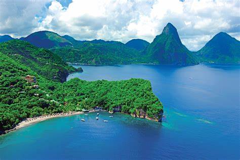
Anse Chastanet is a reef located in a marine protected area on the southwest coast of Saint Lucia. Considered one of the most beautiful reefs on the island, Anse Chastanet has also become one of the most popular scuba diving sites, thanks in part to the nearby hotels. The access areas to the reef are marked by a floating rope in four sections, accessible from the beaches of Anse Chastanet and Anse Mamin.
Discover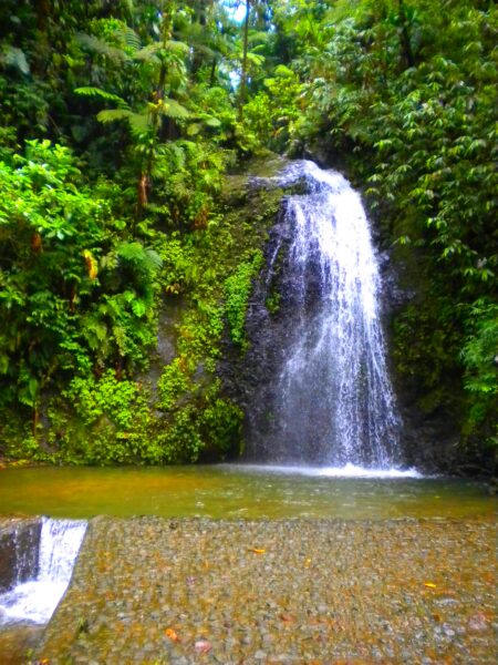
Fond Saint-Denis is located in the north of the island, close to Montagne Pelée. This small area of 24 km² on the slopes of the Pitons du Carbet used to house an observatory for monitoring the volcano. Named the Morne Cadet Observatory, it was also an important site for seismic research.
DiscoverThe bay of the town of Robert is a set of reefs located 3.5 km from the coast. It is almost closed, which allows it to protect the coast from the waves of the Atlantic Ocean. It is 6.5 km long and 3 km wide.
Discover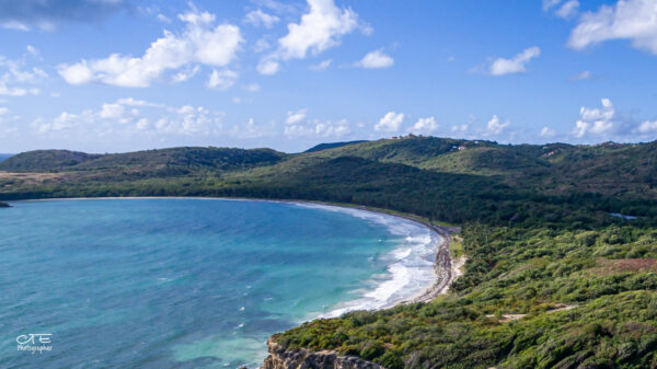
The coastline of the municipalities of Marin and Vauclin has a very high environmental value. Characterized by a great biological diversity composed of: wetlands (ponds, mangroves, backwaters, temporary rivers, marine environments), forest formations on the back beach (the most notable on the island), secondary forests, and hills.
Discover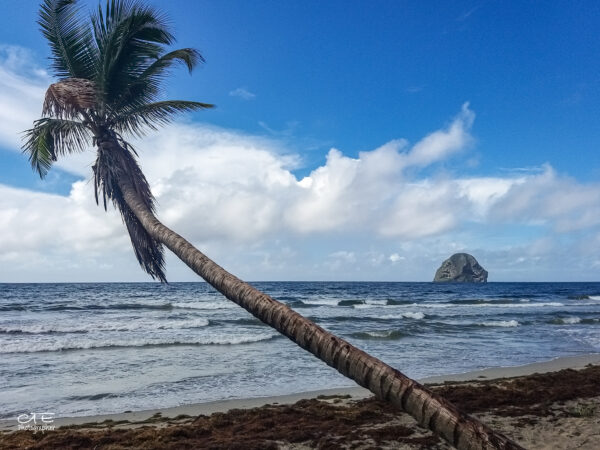
The famous Rocher located in the commune of Le Diamant is a hotspot for biodiversity. Due to its richness, it is part of the coastal conservation area and has also been classified since 1994 as a biotope protection zone, which prohibits access.
Discover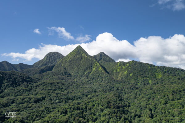
The Pitons du Carbet (Carbet Mountains or Carbet Nails), are a set of volcanic peaks dating from 300,000 to 1 million years ago. They are located northwest of Mount Pelée, the highest point on the island and are older than the latter.
DiscoverJust a few kilometres from the capital, there are many gems of the Martinique forest. The western centre is marked by various hills and the Piton de l’Alma, which offers views of rivers and waterfalls just 20 minutes from the centre. A short hike from the Balata Garden takes you to the Absalon spa, which has unfortunately been abandoned for several years.
Discover
The Caravelle peninsula is part of the “ancient arch”, upon entering you walk on the oldest soils of Martinique (between 18 and 24 million years before our era). It is approximately 10 km long and 1 km wide, and marks the transition between the North Atlantic coast and the South Atlantic coast. Its configuration and relief have favored the development of a wide variety of plant formations and unique landscapes.
DiscoverGalion Forest is a small 15 ha swamp forest area. This type of ecosystem, very important, is the only relic of its kind in Martinique. This lake forest is located south of the municipality of Trinité. It is cataloged as ZNIEFF and was declared a biotope to be protected in 1999.
Discover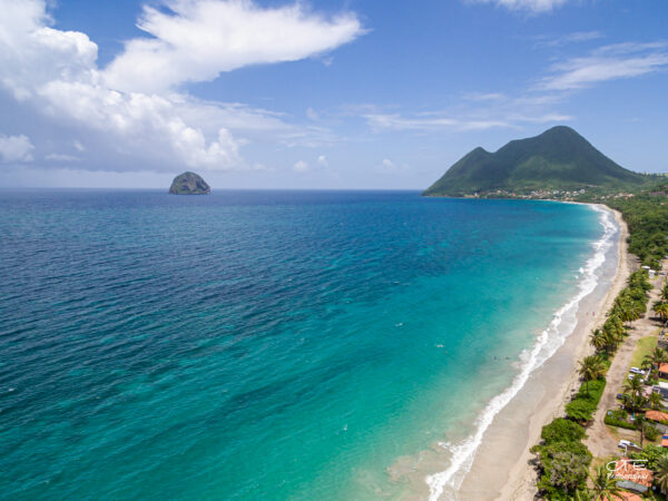
Located on the south coast of the island in the town of Diamant, Morne Larcher is an extinct volcano (1 million years ago) with a height of 478 m. It is part of a volcanic chain born from the fracture that crosses the Trois-îlets peninsula, formed by Morne Champagne, Morne Genty and Rocher du Diamant.
Discover