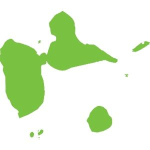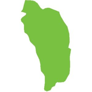
Dominica
751 km²
Caribbean natural sites make up the biodiversity hotspot we know. For example:
The wealth of these islands stems from their volcanic geological history (histoire géologique liée aux volcans). There are currently 21 active volcanoes in the Caribbean. Although some have been dormant for several years, there is at least one on each island, from Saba to Grenada, except in Dominica where there are 9.
Mount Duarte, the highest peak in the Caribbean, is located in the north of the Dominican Republic and reaches an altitude of 3,098 m. Its mountain range extends to the northern massif of Haiti. The highest peak in the Lesser Antilles is the active volcano of La Soufrière (La Soufrière) in Guadeloupe, reaching an altitude of 1,467 m.
Haiti, adorned with geological assets and in particular numerous caves including:,( Marie-Louise Boumba), Jean Zinga but also and above all the Marie-Jeanne cave,(grotte Marie-Jeanne), the longest in the Caribbean with its 5.3 km of gallery. Located at an altitude of 120 meters in the commune of Port-à-Piment in the department of South Haiti, it is classified, to this day, as the largest underground heritage of Haiti.
Guadeloupe and its archipelago hide many secrets with its dual formation (volcanic and limestone). Marie-Galante, formerly attached to Grande-Terre, is a small, flat but surprising island. Discover the Gueule Grand Gouffre or Désirade, the oldest island in the Lesser Antilles, facing the Pointe des Châteaux (the most visited site in Guadeloupe) and the management of Petite-Terre, the only island home only to West Indian iguanas iguanes antillais.
In terms of forest diversity, our territories are home to forests of all types: xerophilous forest, mesophilous forest, hygrophilous forest, high-altitude forest, mangrove… In Haiti, the Pine Forest, located at an altitude of over 2,000 meters, forms a vast, important and emblematic expanse of tropical and subtropical coniferous forests.
Underwater, life abounds. In Guadeloupe, we find the Grand cul-de-sac marin where corals, fish and turtles coexist, sheltered by the largest coral reef in the Lesser Antilles.
In fresh water, many waterfalls are known, notably the Carbet Falls Chutes du Carbet with their history linked to the Amerindians living at their mouths in huts. But also the Saut-d'Eau Waterfall, Cascade Saut-d'Eau , emblematic in Haiti for pilgrimages.
Our biodiversity is rich and interconnected; for it to survive and stay healthy, we must protect every link in the chain. Forests, mangroves, seabeds, seas, rivers, lakes, ponds… all the ecosystems they shelter are a guarantee of the balance of our environment.
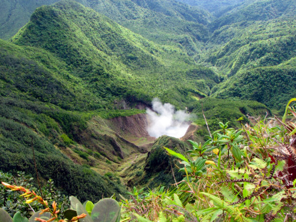
The Boiling Lake is a flooded fumarole located in an area near the Valley of Desolation in southern Dominica. With a diameter of about 60 meters and a depth of around 15 meters, it is the second largest lake of its kind in the world (the largest being the “Frying Pan” lake in New Zealand).
Discover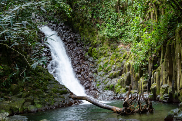
Paradis Gorge Waterfall is located in the town of Vieux-Habitants. Important not to confuse it with Paradise, a small waterfall below the Carbet waterfalls, in Capesterre-Belle-Eau. The most beautiful easily accessible waterfall in the city, it stands out for its wall decorated with basalt columns; its pond, a true bathtub in which it is worth immersing; and its bubbling fall as a backdrop, descending forcefully on the rocky plane over which it rests.
Discover
Located in Vieux-Bourg, Morne-à-l’eau, the picturesque Babin Beach overlooks an extremely calm body of water. The mangroves whose roots bathe in the sea turn the water brackish. Underfoot, a greyish mud attracts more and more bathers.
Discover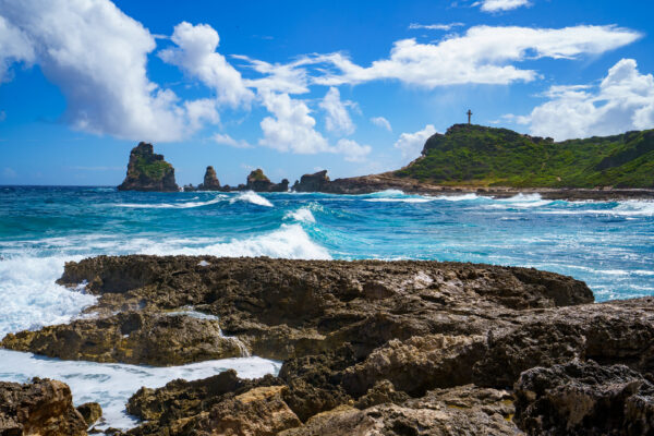
141.10 ha peninsula located to the south-east of Grande-Terre, the Pointe des Châteaux is made up of calcareous* soils covered with xerophytic* plant formations, typical of dry coastal areas. In that area, different environments come together: limestone cliffs, which dominate 43 m above two rocky islets, six lagoons* and several beaches that separate these groups.
Discover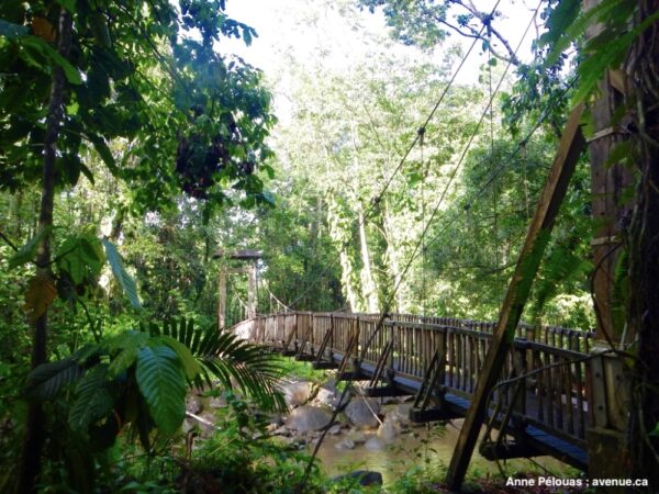
La Maison de la Forêt is located on Route de la Traversée, in the heart of the Mamelles National Park. Gives access to an exhibition on the Guadalupe forest supervised by park agents. There is also a discovery trail, designed and maintained by the National Park, to make the richness of the tropical forest accessible to all, which has twice as many trees as mainland France.
Discover
The Pointe du Vieux-Fort, or point of the Old Fort, is located at the southern tip of Basse-Terre, right on the edge of the Windward and Leeward coasts. The east coast stretches to Petit-cul-de-Sac Marin to the north, while the west coast stretches to Pointe Allègre to the north. It is a region with rugged terrain, so it has long been difficult to access.
Discover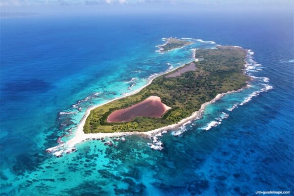
About ten kilometers from the Pointe des Châteaux, is the Petite Terre archipelago made up of Terre de Haut (31 ha) and Terre de Bas (118 ha). Inhabited between 500 and 600 AD, then used around 1493 to grow cotton for Europe and food products for the local population.
Discover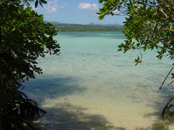
At the confluence of Basse-Terre and Grande-Terre, the Petit Cul-de-sac Marin is connected to the Grand Cul-de-sac Marin by the Rivière Salée. From the islet of Gosier in the south of Grande-Terre to Petit-bourg in the northeast of Basse-Terre, this area is very rich biologically and covers 5,340 ha.
Discover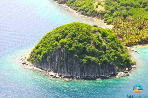
Le Pain de Sucre, a volcanic hill that culminates at 53 meters above sea level, plunges into the bay of Les Saintes. Small peninsula in the west of the island of Terre-de-Haut, made up of Petite Anse, Pain de Sucre (leeward coast) and Anse Devant (windward coast), this is a participant in the title of the most “beautiful bay in the world” ” awarded to the Baie des Saintes in 2018.
Discover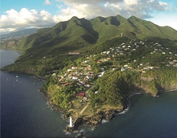
It is south of Basse-Terre where the Caraïbe Mountains meet. This vast expanse that culminates in the “Wind blows” mountain at 687 meters above sea level, is a true ecological jewel. These mountains appeared 500,000 years ago after an underwater volcanic eruption and it was the lava flows from La Soufrière that linked them to Basse-Terre.
Discover