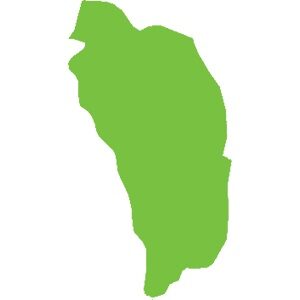
Dominica
751 km²
Caribbean natural sites make up the biodiversity hotspot we know. For example:
The wealth of these islands stems from their volcanic geological history (histoire géologique liée aux volcans). There are currently 21 active volcanoes in the Caribbean. Although some have been dormant for several years, there is at least one on each island, from Saba to Grenada, except in Dominica where there are 9.
Mount Duarte, the highest peak in the Caribbean, is located in the north of the Dominican Republic and reaches an altitude of 3,098 m. Its mountain range extends to the northern massif of Haiti. The highest peak in the Lesser Antilles is the active volcano of La Soufrière (La Soufrière) in Guadeloupe, reaching an altitude of 1,467 m.
Haiti, adorned with geological assets and in particular numerous caves including:,( Marie-Louise Boumba), Jean Zinga but also and above all the Marie-Jeanne cave,(grotte Marie-Jeanne), the longest in the Caribbean with its 5.3 km of gallery. Located at an altitude of 120 meters in the commune of Port-à-Piment in the department of South Haiti, it is classified, to this day, as the largest underground heritage of Haiti.
Guadeloupe and its archipelago hide many secrets with its dual formation (volcanic and limestone). Marie-Galante, formerly attached to Grande-Terre, is a small, flat but surprising island. Discover the Gueule Grand Gouffre or Désirade, the oldest island in the Lesser Antilles, facing the Pointe des Châteaux (the most visited site in Guadeloupe) and the management of Petite-Terre, the only island home only to West Indian iguanas iguanes antillais.
In terms of forest diversity, our territories are home to forests of all types: xerophilous forest, mesophilous forest, hygrophilous forest, high-altitude forest, mangrove… In Haiti, the Pine Forest, located at an altitude of over 2,000 meters, forms a vast, important and emblematic expanse of tropical and subtropical coniferous forests.
Underwater, life abounds. In Guadeloupe, we find the Grand cul-de-sac marin where corals, fish and turtles coexist, sheltered by the largest coral reef in the Lesser Antilles.
In fresh water, many waterfalls are known, notably the Carbet Falls Chutes du Carbet with their history linked to the Amerindians living at their mouths in huts. But also the Saut-d'Eau Waterfall, Cascade Saut-d'Eau , emblematic in Haiti for pilgrimages.
Our biodiversity is rich and interconnected; for it to survive and stay healthy, we must protect every link in the chain. Forests, mangroves, seabeds, seas, rivers, lakes, ponds… all the ecosystems they shelter are a guarantee of the balance of our environment.
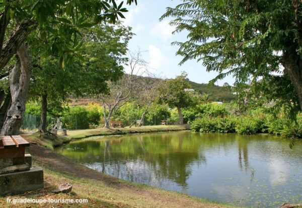
The “Grand-Trou” pond or the pond of the big hole, is located at an altitude of 37 meters, not far from the “Dans fond” district in Terre de bas aux Saintes. Before 1922, it was mainly fed by rainwater, which made it the only drinking water supply point for Petites-Anses.
Discover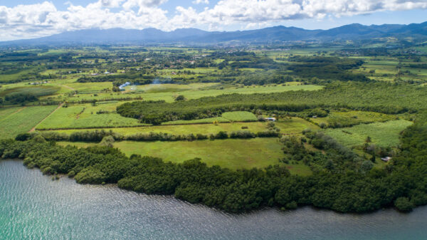
The Grand cul-de-sac marin is a coastal wetland* conducive to the reproduction of terrestrial and maritime flora* and fauna. The “Rivière Salée” is a natural strait that connects the Grand and the Petit Cul-de-sac Marin and unites the Atlantic Ocean and the Caribbean Sea.
Discover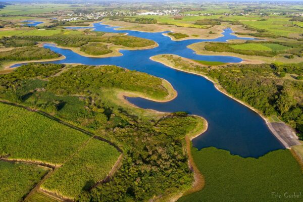
It is in the heart of Grande-Terre, between Port-Louis and Petit-Canal, that the largest body of freshwater in Guadeloupe is located. Built in the late 1980s to irrigate dryland agricultural land in the north of the island, this artificial dam is a biodiversity reserve.
Discover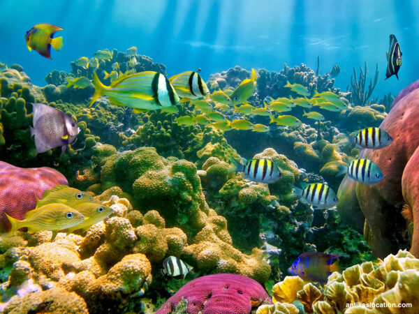
1100 meters away from the coast of the municipality of Bouillante, are the Pigeon islets or Goyave islets. With a total area of 8 ha (7 ha for the large islet and 1 ha for the small one), both islets are formed by volcanic substrate. Separated by a 30 meter channel, they harbor a very important marine biodiversity in their waters.
Discover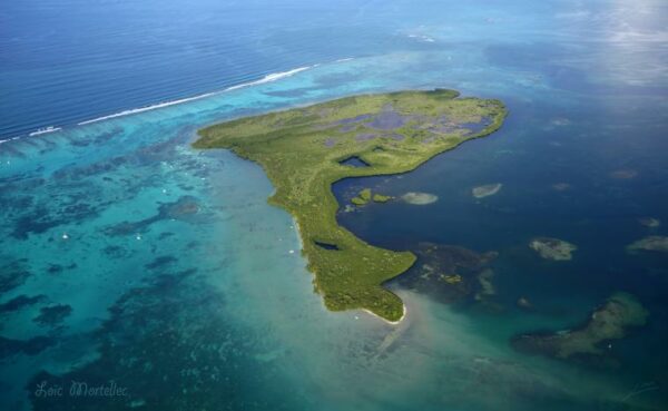
The islet of Fajou is the largest of Grand Cul-de-Sac Marin, located to the east, it covers an area of 119.5 hectares. About 6 km north of the mouth of the Rivière Salée and about 6 km west of the Vieux-Bourg cove, it emerges from a shallow area limited to the north by the coral
reef.
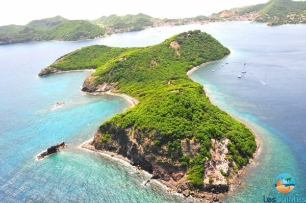
Cabrit’s island, an uninhabited island of almost 38 ha, has retained its wild character with 3.8 km of coastline. Located in the bay of Terre-de-Haut, just 1.2 km away, it played an important role in the constitution of the defensive system, as a fortified lock at the entrance to Les Saintes
between the 16th and 18th centuries.
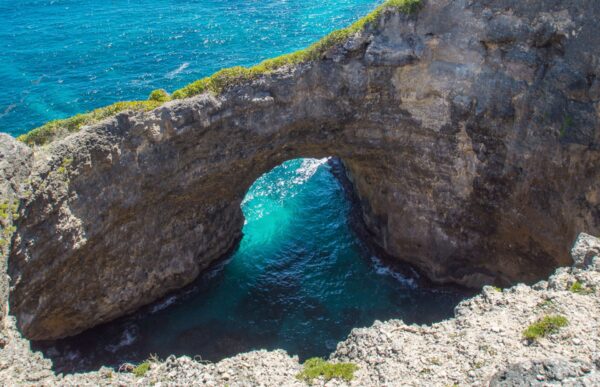
From the viewpoint, it is possible to observe this 30-meter arch formed under the effect of the waves, where the waves break and the foam hits.
Discover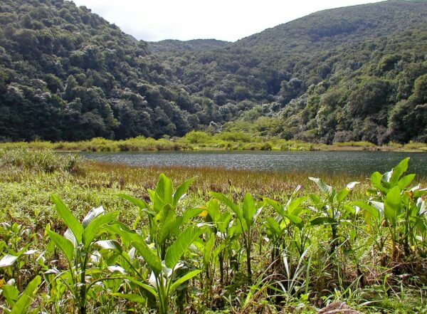
The Grand-Étang, a natural depression* located 400 meters above sea level, covers an area of 5 hectares and has a depth of up to 10 meters in some places. This makes it the largest lake in the Basse-Terre’s mountain range.
Discover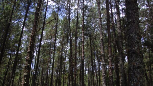
Home to Haiti’s highest peak, La Selle (2,684 m), the Massif de La Selle was declared a UNESCO biosphere reserve in 2012. Known as the first biosphere reserve in Haiti, the Massif de La Selle is the Haiti’s second richest region in biodiversity after the Massif de la Hotte.
Discover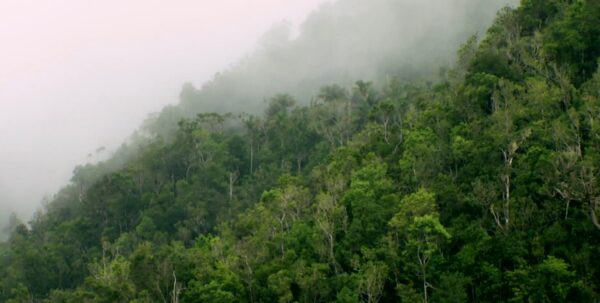
Located in the south of the Haitian peninsula, the La Hotte biosphere reserve covers a total area of 435,195 hectares and is made up of 13 units with legal status of protected areas
Discover